

Tahiti Iti, the verdant “Little Tahiti,” serves as a wild, tranquil counterpoint to its bustling northern counterpart. Connected by the Isthmus of Taravao, this heart-shaped peninsula remains one of French Polynesia’s best-kept secrets, characterized by steep volcanic cliffs, tranquil lagoons, and deep-seated traditions.
Known for the legendary, bone-crushing swells of Teahupo’o and the secluded Te Pari cliffs, Tahiti Iti’s rugged character and compact geography give it a personality all its own. It’s often called the “End of the Road” because Teahupo’o marks the physical ending of the island’s coastal highway and the beginning of the rugged, roadless wilderness of the Fenua Aihere.
We stayed in Tahiti Iti for a month and were based in Taravao.
Tahiti Iti Highlights
Teahupo’o
Teahupo’o (“TAY-ah-hoo-PO-oh”), which translates to “Place of Skulls,” is an ancient settlement with a long Polynesian history spanning hundreds of years. Originally a quiet, traditional fishing village, it is nicknamed “The End of the Road” because the paved coastal highway ends at the village and gives way to the wild, untouched Fenua Aihere region.
Some people refer to it as “Chopoo” or simply “Chopes.”
Teahupo’o’s History
Traditionally, it was the seat of the powerful Vehiatua chiefdom on the Taiarapu Peninsula. The name itself refers to a gruesome boundary wall built from the bones of defeated enemies, marking the territory of the local warriors.

This deep spiritual connection to the land and sea remains today; the village is considered the gateway to the Fenua Aihere, a roadless wilderness where ancient marae (stone temples) still stand as silent witnesses to Polynesian ancestry and legends.
Site Of the 2024 Olympic Surfing Competitions
Although many people say the thunderous wave was first ridden in 1985 by local Tahitian Thierry Vernaudon, others believe the first surfer at Teahupo’o was actually a princess from Raiatea named Vēhiatua. This is according to the memoirs of Marau Taaroa, Last Queen of Tahiti, printed in 1893.
Sadly, Vēhiatua’s supreme wave-riding prowess and popularity deeply threatened the local Tahitian King, Tehei Moe Roa. Consumed by jealousy and believing Vēhiatua held a special, supernatural power, the king had her killed so he could possess her skills and claim the wave for himself. The king then stole her name, making “Vēhiatua” the title for the ruling chiefs of the Taiarapu peninsula.
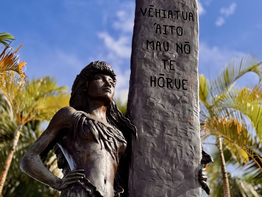
Regardless of its origins as a surf spot, one thing is for certain: it has become known for its heaviest, most dangerous waves on the planet. Because of this reputation, Teahupo’o was chosen as the site of the 2024 Olympic Surfing competitions.
During the Olympic event, local hero Kauli Vaast secured the gold medal for France, drawing on his intimate knowledge of the “end of the road” to defeat Australia’s Jack Robinson, who won the silver medal.

In the women’s division, American Caroline Marks won a gold medal in a tense final against Brazil’s Tatiana Weston-Webb, who took silver.

The event was defined by Gabriel Medina’s viral 9.90 ride—the then-highest single-wave score in Olympic history.

We did not see any athlete housing facilities on the site because that year there was a “floating village” aboard the Aranui 5 passenger ship, which housed the surfers in the lagoon.
The site still bears placards and signs commemorating the event.

The Teahupo’o Wave
Before venturing into town, we decided to take some photos by the iconic Teahupo’o wave.
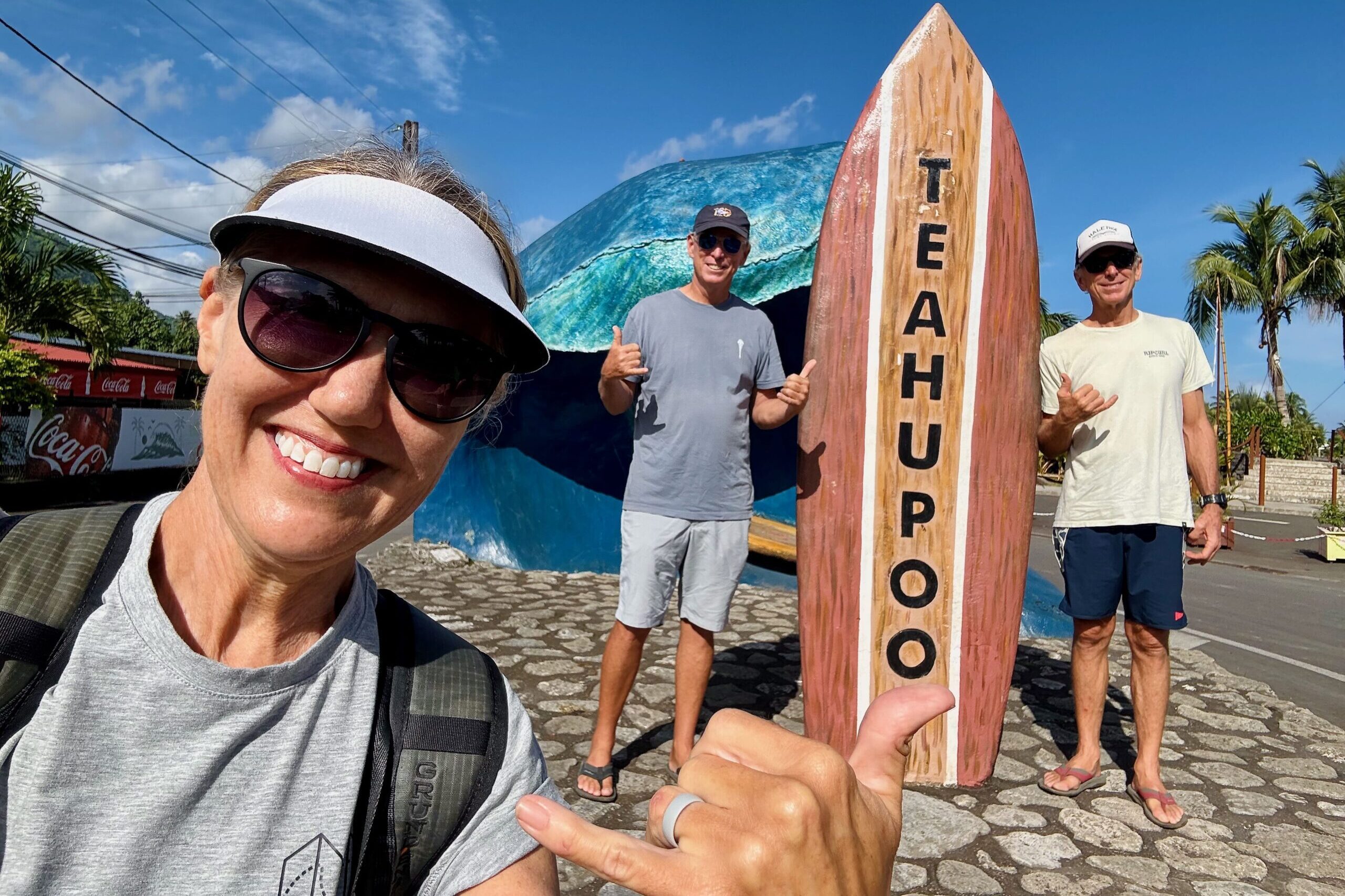
Roy and I then reenacted a photo taken after our wedding more than 30 years earlier:


After we were done snapping pictures, we made our way toward the village.
Teahupo’o Village
We accessed the village by crossing over a bridge that was upgraded for the Olympic Games.


Standing at 4,370 feet, Mount Ronui (Mou’a Ronui) is the highest peak on Tahiti Iti. It looms directly over the Teahupo’o coastline and is often shrouded in heavy orographic clouds, which contribute to the region’s high rainfall and lush jungle.

The mountains are so steep and the jungle so dense that the main belt road around Tahiti simply stops at Teahupo’o. The mountains effectively form a natural wall, protecting the Fenua Aihere (the “wilderness”) from further development. This vertical landscape is responsible for the rapid runoff of water that feeds the many cold-water springs and rivers, such as the Fauoro River, which flows directly into the lagoon.

Originating at the foot of the mountains, it flows for about 14 kilometers through the lush Fauoro Valley before emptying into the ocean right at PK 0, the famous “End of the Road” where the village ends.
The river actually plays a critical role in creating the legendary surf break. Over centuries, the outflow of fresh water from the Fauoro River prevented coral from growing directly in its path, creating the deep Hava’e Pass. When massive ocean swells hit the edge of this deep pass and slam into the shallow coral reef right next to it, they force the water to fold over itself, creating Teahupo’o’s famously heavy, hollow wave.
As we walked along the path, we then came across an oyster shell display, arranged like an entrance to the beach. In Teahupo’o and throughout French Polynesia, the display of oyster shells is a visual testament to the region’s spiritual and economic identity.
Shells are often hung or displayed near homes and boats to invoke the ocean’s protection. They are seen as “vessels of meaning” that carry mana (spiritual power).

As we continued toward the beach, we passed a rustic canoe, which we thought might belong to a fisherman. This would not be surprising, as there is significant fishing activity in Teahupo’o, a small, quiet fishing village widely recognized as such. Near-reef catches include trevally (giant and bluefin), barracuda, bonito, parrotfish, and various snappers. Common fishing techniques include trolling, jigging, and traditional Polynesian hand-line fishing.
On second thought, though, it might be there for a local surfer to reach the break, which is roughly one mile (about a 10- to 15-minute paddle) from the shore. I guess we’ll never know which of these scenarios is true.


In Teahupo’o and the surrounding Fenua Aihere, rubbish burning remains a prevalent but informal method of waste management due to the region’s isolation. While the main village has access to the Fenua Ma union’s green and grey bin collection system, some residents often resort to burning household refuse and brush to manage accumulation. We’ve seen this on many islands, so we weren’t surprised to walk past a beachside burn pile.

I thought the flower someone placed there was a nice touch.
The local community at Teahupo’o, numbering approximately 1,500 residents in the Taiarapu-Ouest commune, maintains a lifestyle deeply rooted in rahui—a traditional Polynesian system of resource management. Life revolves around the ocean and the Fauoro River, with many families relying on subsistence fishing and small-scale agriculture, particularly taro and breadfruit.
The locals were all very friendly to us.

Now on to some surfing.
Wave Watching from our Dinghy
This is what most people see from the shore (sadly, the Olympic platform is no longer there):
With a bit of a zoom:
It’s fascinating seeing the waves break so far from shore.
It was nice, but we wanted to get closer. You can take an excursion boat to the break, but we took our dinghy instead.

It is a bit of a long ride—about eight nautical miles—from Phaëton Bay, but it was definitely worth it. This is what the ride looked like from the dinghy (taken as we were heading back). The scenery is gorgeous.
By going out to the break, we were rewarded with this:
We were so close to the break that Roy had to constantly maneuver the dinghy to keep us from catching a wave ourselves. I’m not going to lie: it was a bit nerve-wracking at times, but it was the experience of a lifetime.

We saw some great surfing that day; in fact, we loved it so much that we took a lunch break and came back for more!

My favorite shot of the day:

Some barrels:


Luckily for us, the judges’ platform was still there:

This is how close those of us in little boats got to the action:

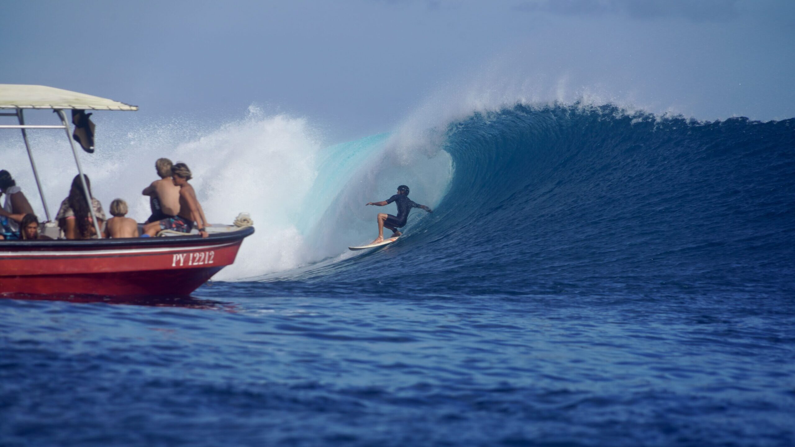
The prime surf season at Teahupo’o is during the Southern Hemisphere winter, running from April to October. This period features consistent, powerful, and large swells, with the biggest, most intense waves often arriving between August and October. We went in July.
Belvédère de Taravao
The Belvédère de Taravao offers one of the most stunning panoramic vistas on the island of Tahiti. Perched high on the Taravao Plateau, this lookout serves as the natural gateway to the Tahiti Iti peninsula. From this vantage point, you get a unique perspective of the narrow isthmus connecting Tahiti Nui to Tahiti Iti, flanked by the deep blue Pacific Ocean on both sides.

The lookout is located where you see the red pin:
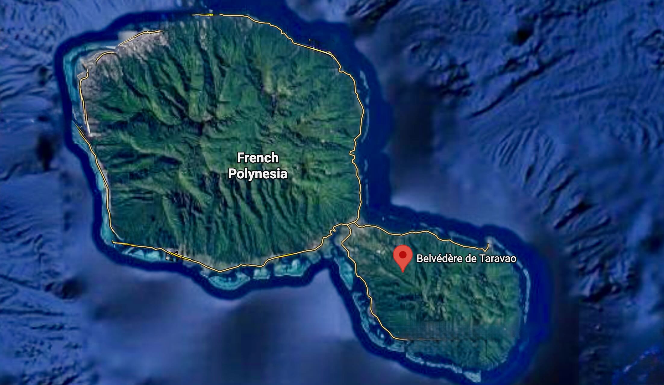
It was a bit rough getting up to the belvédère, so a 4×4 vehicle is recommended. Once we got to the top, though, the view was fantastic.

There’s a worn-but-informative plaque about the site.

While we were there, a local’s vehicle broke down, and everyone came to the driver’s aid. I love that!

While we had a rental car, we decided to drive around Tahiti Iti to see what else was there. It’s pretty much all residential.
Other Things to Do in Tahiti Iti
Te Pari Cliffs Hike
Vaipoiri Cave
Mount Roniu
Fenua Aihere
Vairao Lagoon
Tautira Beach
Getting Around
Taravao serves as the main hub for Tahiti Iti. Even there, you won’t find taxis cruising the streets, so it’s best to order private transportation through services such as Taiarapu Transports (+689 40 54 81 81) or Yota Tahiti (+689 87 79 55 11).
Better yet, rent a car. We rented a car multiple times through Maeva Location Taravao and had a great experience. That’s also the easiest way to get to Teahupo’o.
Where We Ate
We had some great meals in Tahiti Iti. Here’s where we dined, in order of most to least favorite, although they were all great:
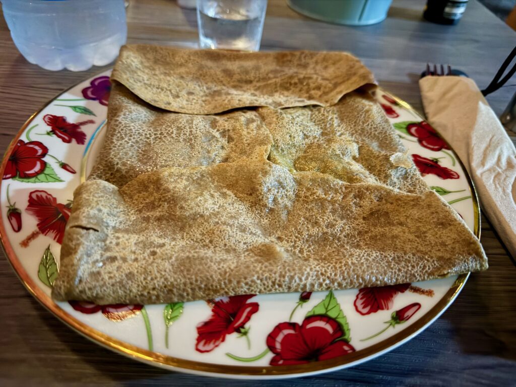
Crêp’Aroa Iti
Le Motu de Mymy (We dined there multiple times):


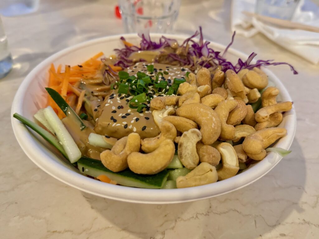
Poke Bar (good but pricey)
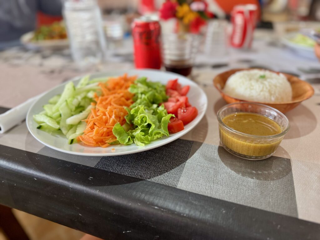
Resto/Snack Hinerava (located behind the Teahupo’o wave)

Accommodations
You have options. There are some lodges in Taravao and further down in Teahupo’o. There are also a number of Airbnbs.
We stayed on our boat in Phaëton Bay.
Getting to Tahiti Iti
It’s easy! Major carriers such as Air Tahiti Nui, Air France, and United offer direct flights from Los Angeles and San Francisco (approximately eight hours) to Faa’a International Airport (PPT). Travelers from Auckland or the Cook Islands can reach Tahiti in under five hours.
The drive from Faa’a International Airport to Teahupo’o (the end of the road) typically takes about one hour and 25 minutes, covering approximately 44 miles. You can also take a public bus (Tere Tahiti bus line 23B/30) for a budget-friendly, two-hour journey.
Final Thoughts
Tahiti Iti, the “Little Tahiti,” offers a raw and rugged contrast to the bustling energy of Tahiti Nui. Connected by the Isthmus of Taravao, this southeastern peninsula is defined by its deep volcanic valleys, the towering peaks of Mount Roniu, and the sheer cliffs of Te Pari, accessible only by boat or foot.
While world-renowned for the legendary “end of the road” surf break at Teahupo’o, the region remains a sanctuary of authentic Polynesian culture and majestic scenery. We enjoyed our quiet month there.


Leave a Reply