
Introduction text.

Headline 1
The wind at Te Rerenga Wairua doesn’t let up. It pushes against my back as I walk the last stretch of path toward the white lighthouse, and it carries the sound of the sea from both sides at once.
Below the cliffs, a line of white water stretches out from the point. On the left is the Tasman Sea. On the right is the Pacific Ocean. Where they meet, the waves don’t break so much as collide, folding over each other in a seam that never quite closes.
On the headland below the lighthouse clings a single gnarled pōhutukawa tree. In Māori tradition, the spirits of the dead travel here, slip down its roots into the sea, and begin the long journey home to Hawaiki. People speak quietly up here. Nobody eats. It’s a place that asks you to pay attention.
We’d come a long way to stand on this spot. The journey here started the day before, about 130 miles to the south, on another patch of grass where everything began.
[IMAGE 2: replace with an Image block set to Wide width. The seam where the Tasman Sea meets the Pacific. Caption: what you’re seeing and why it matters.]
Northland is the long, narrow arm of New Zealand’s North Island that reaches up from Auckland toward the tropics. Locals call it the Winterless North, and it’s where the country’s story was first written. Māori voyagers settled these harbors centuries before Europeans arrived. Whalers, traders and missionaries came next, and in 1840 Māori chiefs and the British Crown signed the treaty that founded modern New Zealand here.
The heart of it all is the Bay of Islands, a drowned river valley scattered with 144 islands. Its towns sit within half an hour of each other: Paihia on the waterfront, Russell across the bay, Opua at the marina, and Kerikeri inland among the orchards. Beyond them, the land narrows and empties all the way to Cape Reinga.
To understand Northland, you travel it in order: from the place where two peoples made a promise to the place where, Māori believe, every journey ends.

A Promise on the Lawn
The Waitangi Treaty Grounds sit on a green slope just north of Paihia, looking out over the bay. On February 6, 1840, Māori chiefs gathered here with representatives of the British Crown to sign Te Tiriti o Waitangi, the Treaty of Waitangi. It is New Zealand’s founding document, and its meaning is still debated today.
The grounds tell that story from both sides. Te Whare Rūnanga, the carved meeting house, faces the white colonial Treaty House across the lawn. Down at the shore, under a shelter, rests Ngātokimatawhaorua, the world’s largest ceremonial war canoe.
[Add what your guide explained during the tour: one thing about the treaty, the carvings or the canoe that stayed with you. Paraphrase if you don’t remember the exact words.]
Then the cultural performance begins inside the meeting house. [Describe it: the challenge at the door, the songs, the haka, how it felt to watch.]
We spent the whole morning here, and it changed how we saw everything that came after. The towns, the place names, even the lighthouse at the top of the country all trace back to this lawn.
[IMAGE 3: replace with an Image block at standard width. Te Whare Rūnanga’s carvings, or your guide. Caption: who or what this is, and the story behind it.]
Quote
The “Hell-Hole” of Days Gone By
The passenger ferry from Paihia takes about 15 minutes, and by the time it noses up to the wharf at Russell, the town looks almost too tidy to be real: white wooden houses, a waterfront lined with old trees, boats swinging on their moorings.
It wasn’t always this way. In the early 1800s, this was Kororareka, a whaling port so rowdy it earned the nickname “hell-hole of the Pacific.” Sailors came ashore for grog and trouble, and found plenty of both.
Some of that spirit survives at the Duke of Marlborough, a waterfront hotel that holds New Zealand’s first liquor license. It still bills itself as “Refreshing Rascals and Reprobates since 1827.” [Add your moment here: the drink you ordered, who you talked to on the veranda, what the bartender or a regular told you about the town.]
Above town, a steep path climbs Flagstaff Hill. In the 1840s, the Māori chief Hōne Heke cut down the British flagpole here four times in protest, and his defiance helped spark the Northern War. Today the hilltop is quiet, with views across the bay to Paihia and Waitangi, the two sides of the story facing each other across the water.
[IMAGE 4: replace with an Image block set to Full width. Russell’s waterfront from the ferry, or the view from Flagstaff Hill. Caption: what the scene shows, and one fact about Russell’s past.]

Stone, River, and Market
Inland, about 25 minutes from Paihia, the land softens into orchards and vineyards. Kerikeri feels like a different Northland, greener and quieter, with the smell of citrus on the air. [Swap in your own first impression.]
At the bottom of town, where the Kerikeri River widens into a basin, stand two of the oldest buildings in the country. Kemp House, a wooden mission house finished in 1822, is the oldest standing building in New Zealand. Beside it is the Stone Store, the country’s oldest stone building, begun in the 1830s to hold the mission’s supplies. It still sells goods today, and tours of Kemp House start from its door. [Add what your tour guide pointed out, or a detail you noticed inside.]
From the basin, a riverside track runs about 2.2 miles upstream through native bush to Rainbow Falls, known in Māori as Waianiwaniwa, “waters of the rainbow.” The river drops 88 feet in a single curtain into a dark green pool. [Describe the walk: birdsong, who you passed, whether you swam.]
On weekend mornings, the whole town seems to gather at the Old Packhouse Market. Saturday’s stalls sell only what’s grown or made in Northland: cheese, bread, avocados, honey, coffee. [Add the stallholder you talked to and what they told you about their farm or their food.]
[IMAGE 5: replace with an Image block at standard width. A detail at the market: hands, produce, a stallholder. Caption: name the person or product, and add one fact the photo can’t show.]

Final Thoughts

Text
Essentials
- Getting Here: Drive about 3–3.5 hours north from Auckland, or fly to Bay of Islands Airport in Kerikeri.
- Getting Around: A rental car is a must. We rented ours through Blue Star Rentals and would highly recommend them. Passenger ferries cross between Paihia and Russell all day, and the Opua–Okiato car ferry runs about every 10 minutes from 6 a.m. to 10 p.m.
- When to Go: November to April. December to February are busiest; November and March are warm and quieter.
- Cash & Cards: Text
Worth Booking
- Waitangi Treaty Grounds: A two-day pass with guided tour and cultural performance is NZ$74 for international adults. Open 9 a.m. to 5 p.m., until 6 p.m. December to February. You can buy tickets onsite, but booking in advance will ensure you get a tour that coincides with the cultural show, which runs only three times per day.
- Salt Air Cape Reinga fly/drive tour: Leaves Kerikeri Airport at 8:30 a.m., back about 1:30 p.m., with free pickup in Paihia. This is what we did. From June to September, it becomes a 2-hour scenic flight because the airstrip is too soft to land.
- Salt Air Cape Reinga VIP helicopter tour: A private full-day version, with helipad pickup available. Price on request.
Where to Stay

Paihia Beach Resort & Spa | PAIHIA
TYPE · MODERATE
About 20 rooms, steps from Te Tii Beach, with a pool and spa.

The Duke of Marlborough | Russell
TYPE · UPSCALE
A historic waterfront hotel; home of New Zealand’s first liquor license.

Eagle’s Nest | Russell
TYPE · LUXURY
Private villas on a headland with a pool, perched over the bay.
Where to Eat

Charlotte’s Kitchen
NEW ZEALAND & GLOBAL FUSION CUISINE · MODERATE
At the end of the wharf; go for happy hour. We enjoyed the salads and roasted vegetables here.
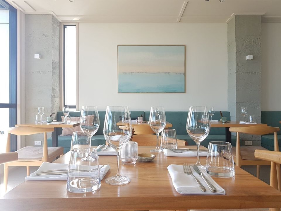
Terra
NEW ZEALAND & GLOBAL FUSION CUISINE · UPSCALE
One of Northland’s two Cuisine-hatted restaurants; try the chef’s tasting menu.

Sage at Paroa Bay Winery
TYPE · LUXURY
The region’s other hatted restaurant; open Wednesday to Sunday from noon.
We also recommend CBK Craft Bar & Kitchen (Paihia) and Seaside (Russell).
Resources
Checked November 2026. Confirm hours and prices before you go.
- Waitangi Treaty Grounds admissions
- Northland Ferries: Bay of Islands ferries
- Salt Air: Cape Reinga fly/drive tour
- Salt Air: Cape Reinga helicopter tours
- Terra and Sage hats, Northern Advocate
- Kerikeri, newzealand.com
- Biosecurity NZ yacht arrivals, via Noonsite
- Opua clearance, Noonsite
- Bay of Islands Marina, via Boaties
If Arriving by Private Yacht
- Arrival & clearance: Opua is one of Northland’s two ports of first arrival. Submit advance notice before leaving your last port, fly the Q flag, call Bay of Islands Radio on VHF 16, and tie up at the quarantine dock on the marina’s outer breakwater. Stay aboard until cleared, and declare all fresh food.
- Anchorages & moorings: Off Opua in 10–16 feet over mud; Waipiro Bay in 13–20 feet; Roberton Island’s lagoon in 10–16 feet over sand with good holding; and off Russell.
- Marinas: Bay of Islands Marina (VHF 73) has about 420 berths, power up to 125 amps, fuel, laundry and Wi-Fi, plus a 50-ton travel lift and catamaran haul-out.
- Provisioning & services: The Opua General Store for basics and SIM cards; supermarkets in Paihia and Kerikeri for big shops. Port Opua Marine Park has riggers, sailmakers, mechanics, and two chandleries.
- Season & weather: The Pacific fleet arrives October to December and leaves around May.
- Our boat note: [One line on the catamaran.]

Leave a Reply